OUR PROGRAMS
Diploma in Land Surveying
About Course
Course Description
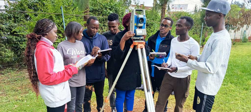
This specialized technical program is designed to equip students with theoretical knowledge and practical skills in land measurement, mapping, and geospatial data analysis. This program integrates modern surveying techniques, geodetic principles, and GIS applications, ensuring that graduates can effectively conduct:
- Cadastral surveys,
- Topographic mapping,
- Engineering and hydrographic surveys,
- Control surveys.
The course focuses on hands-on training using advanced surveying instruments such as:
- Total Stations
- Digital & Dumpy Levels
- GPS Receivers
- GIS Software (ArcGIS, QGIS, ERDAS Imagine)
- Land Surveying Software (AutoCAD Civil 3D, Global Mapper)
Students will also develop expertise in data processing, cartography, and land administration, including the legal and ethical aspects of land surveying.
Entry Requirements
To be eligible for admission, candidates must meet one of the following criteria:
- Minimum Entry Requirements:
- KCSE Mean Grade: C- (Minus) or equivalent
- Subject Requirements:
- Mathematics: D+ (Plus) or higher
- Geography & Physics: D+ (Plus) or higher
- Alternative Entry Qualifications:
- Certificate in Land Surveying or a related field from a recognized institution.
Career Opportunities
Graduates can pursue careers in:
- Government Surveying Departments
- Private Land Surveying Firms
- Urban and Regional Planning Agencies
- Construction & Civil Engineering Firms
- Geospatial Data Analysis & GIS Consulting
- Real Estate Development & Land Valuation
- Environmental & Hydrographic Surveying
Why Choose This Program?
- Hands-on training with modern surveying instruments and GIS tools.
- Exposure to advanced surveying technologies, including GPS, Remote Sensing, and GIS applications.
- An industry-relevant curriculum that aligns with professional land surveying standards.
- Strong career prospects in both public and private sectors.
- Opportunities for further studies in Bachelor’s programs related to Land Surveying, Geospatial Science, or Civil Engineering.
For additional information, please contact us via
Email: rcti@rcmrd.org or
Call/WhatsApp: 0101 777 778 or 0114 444 460.
Lessons
- [Lesson] Meet Your Instructor: Kelly Blue Duration: 0:45:00
-
[Lesson] Meet Your Instructor: Kelly AurcherDuration: 0:10:00
-
[Lesson] There are many variations of passages of Lorem Ipsum availableDuration: 0:40:00
-
[Lesson] There are many variations of passagesDuration: 0:35:00
-
[Lesson] All the Lorem Ipsum generators on the InternetDuration: 0:25:00
Class Times
| Sunday | Monday | Tuesday | Wednesday | Thursday | Friday | Saturday |
|---|---|---|---|---|---|---|
|
|
|
|
|
|
|
|
Meet Our Teacher

Adolfo Serra
illustrator, Artist, Motion
Smitt Vivien
Finance, Marketing
Fedrik Edword
interaction, Motion
John Addison
Finance, interaction
J. Castaneda
C++, JavaScript
Magyar Dora
interaction, PHP
John Deoio
Design, Developmentmod_splms_courses
Warning: Undefined property: stdClass::$description in /home/oer0bv54p2ue/public_html/rcmrd.institute/templates/edulif/html/com_splms/course/default.php on line 440
Warning: Undefined property: stdClass::$description in /home/oer0bv54p2ue/public_html/rcmrd.institute/templates/edulif/html/com_splms/course/default.php on line 440
Warning: Undefined property: stdClass::$description in /home/oer0bv54p2ue/public_html/rcmrd.institute/templates/edulif/html/com_splms/course/default.php on line 440
Warning: Undefined property: stdClass::$description in /home/oer0bv54p2ue/public_html/rcmrd.institute/templates/edulif/html/com_splms/course/default.php on line 440
At RCTI, we empower you to push boundaries and unlock your potential


