About Course
Course Description
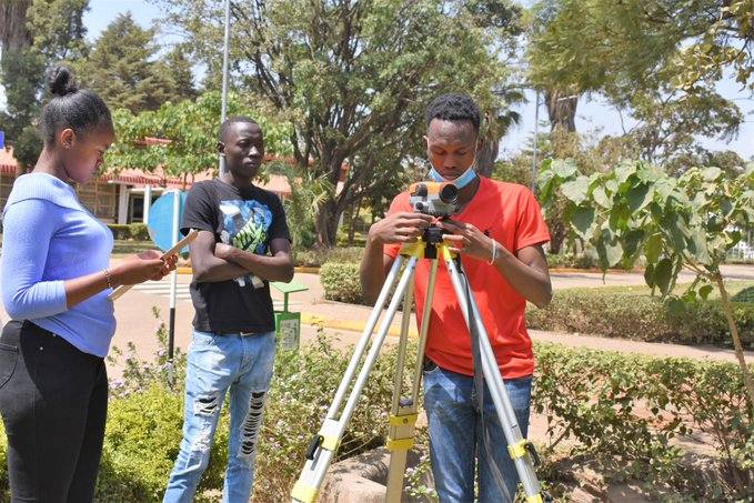
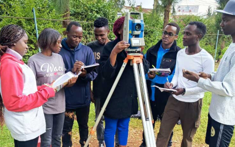
This foundational program is designed to equip students with basic knowledge and practical skills in surveying, mapping, and land measurement. The course introduces students to fundamental surveying techniques, boundary demarcation, and cartographic representation using both traditional and modern surveying instruments.
Students will gain hands-on experience working with:
- Compasses
- Leveling Instruments
- Theodolites
- Total Stations
- Introduction to GIS and Remote Sensing Applications
This program prepares graduates for entry-level roles in land surveying, construction, and civil engineering projects, as well as further academic progression in surveying-related disciplines.
Course Objectives
By the end of the program, students will be able to:
- Conduct basic land surveys using traditional and modern instruments.
- Apply leveling techniques for contour mapping and construction surveys.
- Read and interpret survey plans and cadastral maps.
- Understand fundamental geodetic and cartographic principles.
- Assist in boundary demarcation and topographic surveys.
- Use computer applications for basic mapping and data processing.
- Follow legal and ethical guidelines in land surveying practices.
Course Duration
- Total Duration: 1½ years (5 Terms/Semesters)
- Mode of Study: Full-time
- Course Structure: 5 Terms, including practical fieldwork
Entry Requirements
To be eligible for admission, candidates must meet one of the following criteria:
- Minimum Entry Requirements:
- KCSE Mean Grade: D (Plain) or equivalent
- Subject Requirements:
- Mathematics & Physics: D (Plain) or higher
- Alternative Entry Qualifications:
- Equivalent qualifications as recognized by relevant educational authorities.
Career Opportunities
Graduates can secure entry-level roles such as:
- Survey Assistants in government and private land surveying firms
- Field Assistants in construction and civil engineering projects
- GIS & Mapping Assistants in geospatial firms
- Cadastral Survey Technicians in land administration offices
Progression Opportunities
Upon completion, graduates can advance to:
- Diploma in Land Surveying
- Further certifications in GIS, Remote Sensing, and Surveying Technology
Why Choose This Program?
- Hands-on training with modern surveying instruments.
- Industry-relevant curriculum covering practical and theoretical aspects.
- Strong foundation for career advancement in surveying and mapping.
- Opportunities for further studies in land surveying and related fields.
Intakes
The program has three (3) intakes per year: